

Coe Operations GB Counties is a test and training app to improve your knowledge of British flags, county towns and, more importantly, the ability to place counties on a map. It includes links to Kiddle (Kids Encyclopedia Facts) or Wikipedia for further information and is designed to be as intuitive as possible.
Several metropolitan counties are included, partly because of the availability of suitable maps. Where they do not have recognised county towns the largest town has been chosen instead. The thirteen traditional counties of Wales are used rather than the eight preserved ones of today.
Albeit not abbreviations, as a courtesy to Welsh speakers the abbreviation facility of the Option List has been used for Welsh names, although 'Sir' has been dropped, enabling their input if preferred.
The Android installer has been temporarily withdrawn while examining an issue with backspacing on some devices. Click the icon above to play in your web browser.

Individual countries can be selected by tapping or clicking the menu bar buttons at the top. The default option is the whole of Great Britain. Your selection is saved for launching next time in the Android app or your web browser's local storage.


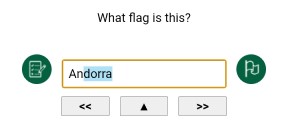
There are two views, Flag View and Map View where you can learn or test your knowledge of different counties' locations. Click the button to switch views except in Flash Test Mode.


There are two modes, Display Mode that shows counties and their county towns and Test Mode. Display Mode comprises hyperlinks from the flags, maps and county towns to their respective Kiddle (Kids Encyclopedia Facts) or Wikipedia pages. Kiddle is the initial option for juniors, toggle the bottom right hand button for Wikipedia.
Display Mode has a Play button to move on every seven and a half seconds, so the screen stays on because of its slideshow characteristics in the Android app and in most browsers. Do not leave your device unattended as it could drain the battery. You will be asked however whether you are still watching after 10 minutes of inactivity.
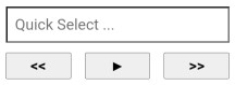
You can type single characters with Quick Select to jump to counties beginning with that letter or to the next available option, rolling over to the first if there are none. You may use the Option List if you prefer to go straight to your chosen destination. Backward and forward buttons are also provided for navigation; the Left and Right Arrow keys can be used instead when viewing on a computer.
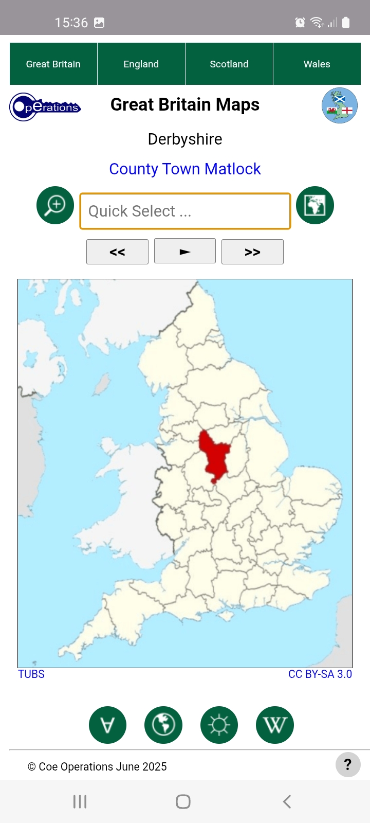
Maps are best viewed by country in Display Mode as it effectively fixes the map with no movement.
GB Counties launches in whichever mode was last used if local storage has been granted. Click the Mode button to cycle between them.
There are two primary test modes for testing your knowledge of county flags or locations, just switch view for either. Switching is discouraged during tests however but can sometimes help as a prompt if you're stuck.
Tests should be conducted in portrait orientation on moble devices to accommodate the virtual keyboard, which may be hidden on phones for visibility in map view. Tap the input field to activate and once more if you wish to hide the Option List.

There are three further test options, 10 random questions or all counties in your chosen country, a City option for testing your knowledge of county towns plus Flash Test Mode for accomplished users wanting an extra challenge. Flash Test Mode flashes flags up for one tenth of a second or maps for a half and is not available for city tests.

The final button is not actually a test button but as stated above is for choosing between Kiddle and Wikipedia for information on countries or their capitals.
You may skip or go back to earlier questions as and when you please. Correct solutions are shown after three wrong answers and may be reviewed at the end of the test. Press the central Stop button to exit the review.
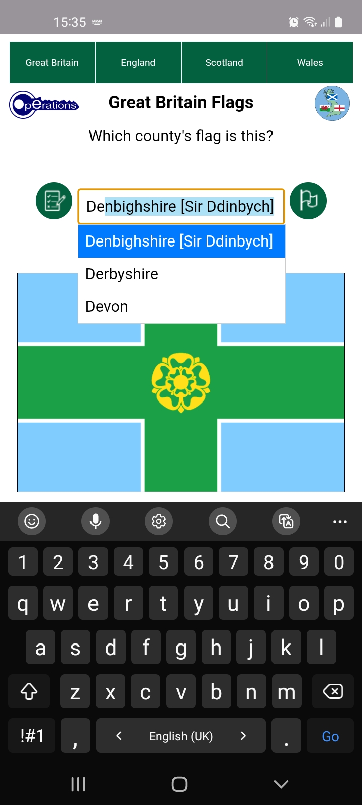
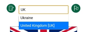
Typing is the preferred input method. Options beginning with entered text are filtered and autocompleted as you type, as shown above and in the following image. Since options are limited to those in the list, you are audibly warned when none exist, most likely the result a typing error, and the offending character is removed. Just accept the free hit if it wasn't a typo.
Press Enter/Go or the central Submit button once filtered to the first or last remaining option, as shown above, to submit that as your answer. No further typing is necessary. Use the Backspace key as usual to correct mistakes.
Abbreviations are accepted too. GB Counties now uses Chapman codes, which substantially reduces input. They are enclosed within square brackets in the Option List.
Merionethshire is a special case where its abbreviation does not filter to a single option but is selected as complete. You may therefore press the Enter/Go key to submit or continue typing to filter it out.
This facility has also been used for alternative inputs such as Welsh names should you prefer. You can find them all by scrolling the full list.
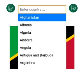
Selection can also be made by directly interacting with the Option List itself. Tap or click the input field at any time to show or hide it. Nothing is displayed where no options match the text in the input field, whereas all options are available when there is none.
The list can be swiped as usual on touch screens or scrolled with the mouse wheel on computers. Items are selected by tapping or clicking them. Press the Submit button or the Enter/Go key to submit your answer. Of course you may use a combination of typing and the Option List.
The Down Arrow key can also be used on computers to activate the option list if hidden. Use the Up and Down keys to scroll and dynamically make selections, then press Enter when ready. This can also be done in Quick Select mode.
User preferences are saved in the Android app and, if permitted, your browser's local storage, so your settings and whether you closed during a test can be restored. If you have more correct than wrong answers you are asked whether you wish to resume the test next time you launch the app.
If granted, local storage is also used for app data to minimise load time.
Bug fixes or additions in the latest release.
07/06/2026
Fixed: Immediately showing virtual keyboard when launching flag tests.
27/05/2026
Updated: Rolling Display Mode moves on every seven and a half seconds
rather than the arbitrary five to aid memory retention.
24/05/2026
Updated: Show city during City Test reviews.
Updated: Show the Chapman county code in Display Mode.
Updated: Option List now includes Unicode characters but filtered in ASCII.
Updated: Images better scaled on iPhones during tests.
16/05/2026
Added: Chapman county codes as abbreviations.
Updated: Use local storage to save and retrieve state data if allowed.
Updated: Questions are no longer repeated after three wrong answers but can be
reviewed at end of test.
Updated: Next scheduled image is preloaded when current one displayed.
Updated: Layout has been further improved to adapt to more devices and orientation
changes.
Updated: Reverted to png map files that have now been compressed.
Removed: Timed test button as timed tests are no longer planned.
12/05/2026
Fixed: Missing web pages in Kiddle now fixed so that virtual keyboard is
always hidden after Quick Select.
10/05/2026
Updated: Use local storage to save and retrieve county data if allowed.
Updated: Questions are no longer repeated after three wrong answers but can be
reviewed at end of test.
Updated: Next scheduled image is preloaded when current one displayed.
Updated: World Flags now uses a database as a precursor for foreign language
support.
Updated: Layout has been further improved to adapt to more devices and orientation
changes.
Updated: Reverted to png map files that have now been compressed.
Removed: Timed test button as timed tests are no longer planned.
06/04/2026
Updated: Repackaged map files as jpg for smaller file sizes.
13/03/2026
Updated: New layout for computer screens in landscape view.
Updated: Buttons with images rather than text.
Added: New test option buttons.
Updated: Improved reliability of audible feedback.
18/02/2026
Fixed: Issues with input, especially after backspacing.
13/02/2026
Updated: Progress bar and timer reset when following links in Rolling Display Mode.
Updated: Maps properly accredited.
Fixed: Input re-enabled when changing mode, country or test type when showing
correct answer.
Updated: County town question placed higher up page.
08/02/2026
Updated: Resized buttons to accommodate translated text.
05/02/2026
Added: Tests saved in local storage for resuming at next launch.
Added: ID or index field to Option List items.
Allowed: Numerals no longer excluded from input to facilitate Unicode characters
when using a computer in a foreign language.
Updated: Fixed and Rolling Display Modes combined into one since introduction of
the Play/Pause button.
11/01/2026
Fixed: Option list resized for small screens.
10/01/2026
Added: Selected country in user preferences.
09/01/2026
Added: Flag/Map View included in user preferences.
07/01/2026
Added: User preferences to Android app and web browser if permitted
(Kiddle/Wikipedia & launch in Display/Test Mode).
All flags have been sourced from British County Flags.
All maps have been cropped and resized from originals sourced from Wikimedia Commons, some with minor edits and Welsh ones recoloured for consistency.
You are free to use and distribute this software or web package provided it is accredited and supplied in its entirety with no alteration and that no fee is charged. All source code remains the property of Coe Operations.
© Coe Operations June 2025